Things to Do at Grand Canyon West Skywalk
A glass walkway over the canyon at Eagle Point, on Hualapai Tribe land
The Skywalk at Eagle Point
The Skywalk is a horseshoe-shaped cantilever bridge with a glass walkway. It sits at Eagle Point in Arizona, within the Grand Canyon West area.
The attraction began drawing tourists in 2007. Grand Canyon National Park's boundary does not take in the Skywalk.
USGS topographic maps give the Skywalk's elevation as 4,770 feet (1,450 m) above sea level. The Colorado River at the base of the canyon below the Skywalk is at an elevation of 1,160 feet (350 m).
| Location | Elevation | Source of figure |
|---|---|---|
| Skywalk, above sea level | 4,770 feet (1,450 m) | USGS topographic maps |
| Colorado River at the base of the canyon below the Skywalk | 1,160 feet (350 m) | Elevation of the river at that point |
Canyon views and the rim
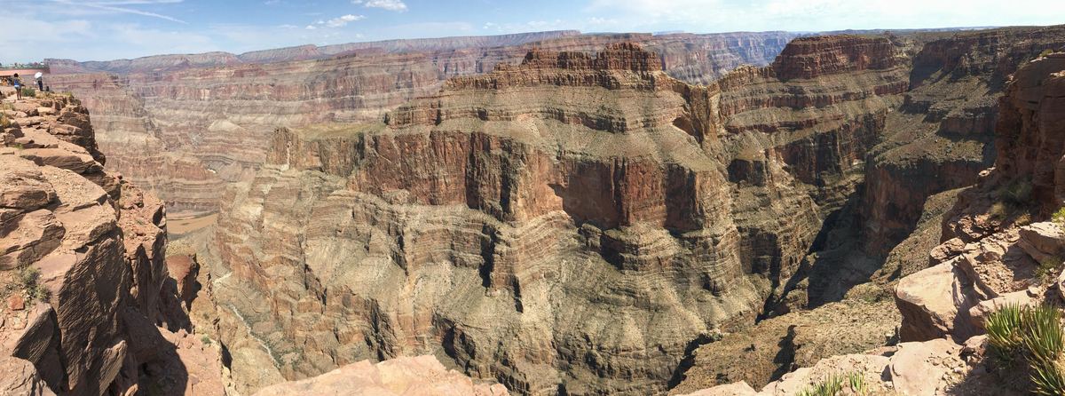
At Guano Point, the remnants of a closed mine tramway headhouse stand alongside a panoramic canyon view.
The official Grand Canyon West site frames a visit as a journey six million years in the making.
Below the Skywalk, the Colorado River runs at an elevation of 1,160 feet (350 m) at the base of the canyon.
Where the Skywalk sits
Grand Canyon West is a tourism development on the Hualapai Reservation in Mohave County, Arizona. It sits at the northwestern corner of the reservation and borders Grand Canyon National Park at the Colorado River.
The official site states that Grand Canyon West is located on the sovereign lands of the Hualapai Tribe.
Within the census-designated place known as Grand Canyon West, the total area comes to 17.6 square miles (46 km2).
Kingman, Arizona, is the city with a population above 10,000 and lies about 50 miles (80 km) south of the Skywalk.
The Skywalk is about 75 miles (121 km) east of Las Vegas in a straight line, but the drive by car is nearly 130 miles (210 km).
Diamond Bar Road runs southwest for 20 miles (32 km) from Grand Canyon West to County Highway 25 near Meadview.
| Measure | Figure | Detail |
|---|---|---|
| Las Vegas to the Skywalk, straight line | About 75 miles (121 km) | East of Las Vegas |
| Las Vegas to the Skywalk, by car | Nearly 130 miles (210 km) | By car |
| Diamond Bar Road | 20 miles (32 km) | Southwest from Grand Canyon West to County Highway 25 |
| Kingman to the Skywalk | About 50 miles (80 km) | South of the Skywalk |
| Grand Canyon West census-designated place | 17.6 square miles (46 km2) | Total area |
History and cost
Grand Canyon West was established in 1988 around a dirt airport, and it originally offered tours led by tribal members.
- 2007Skywalk opened as a tourist attraction
- 1988Grand Canyon West established
- 2015First year passing 1 million annual visitors
- 2023Solar-powered microgrid with battery storage installed
The Skywalk's cost is given as between $30 million and $40 million. Hualapai officials put it at $30 million, while the Grand Canyon West article gives $40 million for the 2007 opening.
Some Hualapai tribal members had opposed the Skywalk project, seeing it as a disturbance of sacred ground. Annual visits crossed 1 million for the first time in 2015.
Tribal operations and airspace
In 2023, the Hualapai tribe installed a solar-powered microgrid with battery storage. Its stated purpose is to reduce diesel use.
Water for the development is trucked in from elsewhere rather than taken from the Colorado River.
Tours and activities
Tours and activities at Grand Canyon West
Tour listings
Browse toursQuestions about the site
Frequently asked questions
How far is the Skywalk from Las Vegas?
It is about 75 miles (121 km) east of Las Vegas in a straight line, and nearly 130 miles (210 km) by car.
When did the Skywalk open to tourists?
It opened as a tourist attraction in 2007.
Does the park's boundary take in the Skywalk?
No. The attraction falls beyond the park's boundary.
How high is the Skywalk above sea level?
USGS topographic maps give its elevation as 4,770 feet (1,450 m).
Who controls the land at Grand Canyon West?
The official site says the area is on the sovereign lands of the Hualapai Tribe.
In which year did yearly visits first top 1 million?
2015 was the year the yearly total first topped 1 million.
How big is the census-designated place named Grand Canyon West?
Its total area is 17.6 square miles (46 km2).
Is there a solar project at the site?
Yes. A solar-powered microgrid with battery storage was installed in 2023 to reduce diesel use.